Road Surface Scanning Solution
(LiDAR Technology)
The mobile scanning devices in the Road Surface Scanning Solution record road conditions with high precision ($lt2mm), enabling detection of invisible anomalies and integrating with the monitoring dashboard in the Command Center for decision-making.

- Road quality management
- Planning for preventive and curative measures in road maintenance
- To detect Road Obstruction
- For road topography mapping
- For proving ground profile management
- Digital twin road asset
- Research and simulation
Road Measurement with Digitization Technology

- High accuracy short range LIDAR for road surface measurement
- Unaffected by environmental light conditions
- International standard IRI (International Roughness Index)
- All roads will be digitized regularly and completely to:
- Create/maintain an inventory of road infrastructure (roads, traffic signs, markings)
- Give all stakeholders easy access to centralized data to enable online and automated road quality control
- Save money thanks to predictive maintenance
- Real-time analysis of rough road profiles
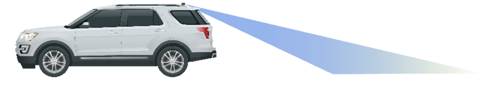
Flow LIDAR Scanner
- LIDAR Scanner will record road conditions.
- The AI engine will convert the scan results of the road surface geometry.
- Detailed analysis can be done in 2D and 3D.
- Accuracy level up to < 2mm.


Trends Analysis
- Road crack analysis
- Quantification of road degradation
- Road maintenance suggestions

Road Characteristics
- Standard IRI
- Longitudinal strain
- Transverse wave/Rutting
- Pothole detection & characterization

Data Real-time
- 2D camera image per meter
- 3D Rolling Carpet
- Reflectivity map
- GPS & IMU values, synchronized with LIDAR data